Believe it or not, it took over a year to get the funding, design them, construct them and get them installed. Initially we got funding from the Toronto and Region Conservation Authority. However since they were being installed in a city park, the city's communication department had to sign off on the text. This is where most of the delays occurred. We lost count the number of times we submitted drafts of text to them and they would return it with corrections. At least twice they changed the species name even though we had given it to them and told them "Don't change this". Arrgh! In a previous post I mentioned that the government bureaucracy was one of the five biggest threats to the restoration of the Don. This is but one small example.
So after what seems like an eternity, the interpretive signs we order are now installed. Ironically, the money for the signs came from a grant from the TRCA to the Task Force. We gave it to the city to build them, but we had to give them back to the TRCA who did the installation.
Of course no one told us they had been installed, I just happened upon them on one of my regular tours. I took a close look. In the bottom left hand corner are seven logos of all the companies and government departments that had a hand in the funding. It's darkly humorous to note that each of them is named except the Bring Back the Don fish logo. After all the trouble, hassle, and frustration we went through to get these installed, we can't even get our own name on the sign. Screwed again!
Still I shouldn't complain too much. They are now installed and they do look nice. The sites themselves were created in 1998 and since then they have done so well that it's hard to actually see the ponds anymore as the trees, bushes, and rushes now obscure most of the water.
If you haven't visited this park you should. It's one of the nicest mid town ravine parks that meanders south east from St. Clair West subway station for about 1 km. Lost Rivers has a good map of the area.
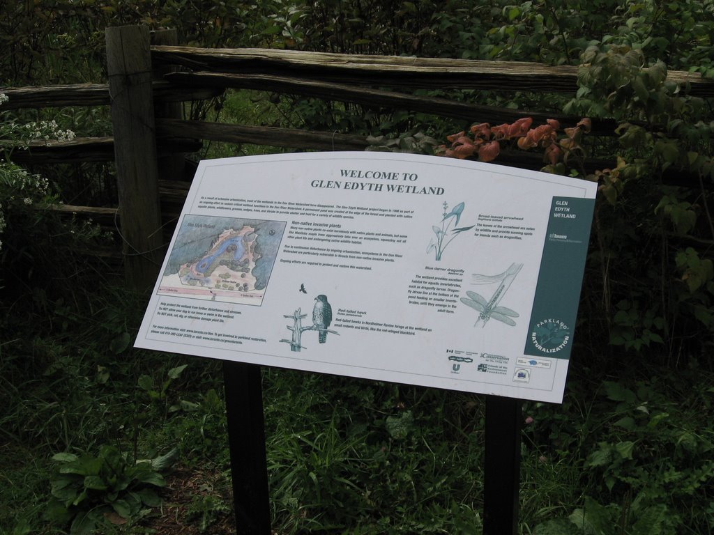
New sign for Glen Edyth Wetland
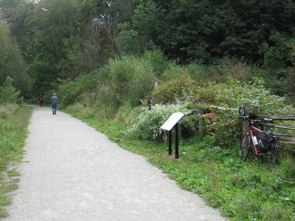
The Glen Edyth wetland (my trusty steed is on the right)
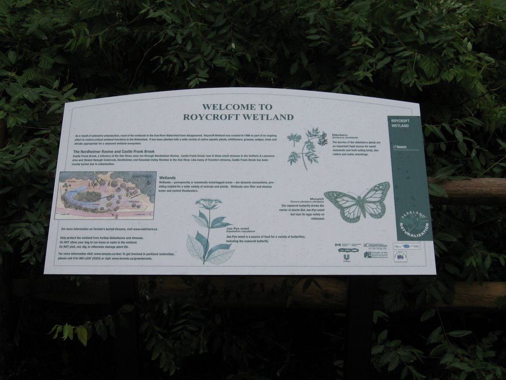
Roycroft Wetland sign
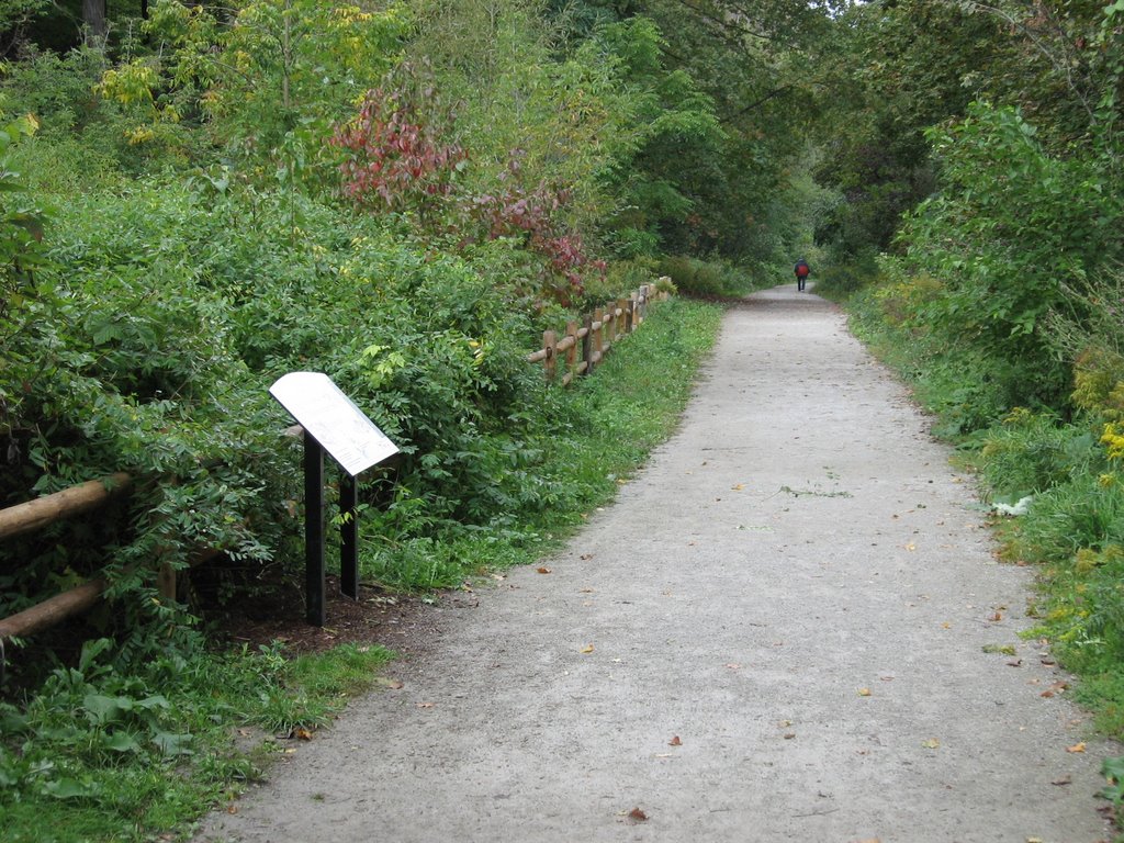
Path next to Roycroft Wetland

2 comments:
After all the work there, its good to see these signs.
Its great to see the photos, I am with the company that manufactered the graphic panels, Izone Imaging.
Thank you!
Post a Comment