Tuesday, August 30, 2005

Cracked!


Along the lower Don are planted a number of trees called Crack Willow (Salix fragilis). This species is not native to Canada but is introduced from England. They produce a dappled shade which I suppose is aesthetically pleasing to some. Fortunately they are not invasive. They are a common park tree and you will find dozens in places like the Toronto Islands.

It gets its name from the sound when its twigs break off which creates an audible pop. In its native range the tree is supposed to have a lifespan of up to 100 years but in Toronto they have an annoying habit of falling over after only about 50 years.

The one depicted here is on the lower Don trail just north of Queen St. East. It didn't fall during the storm two weeks ago but was likely weakened by it. Nevertheless it is the city's forestry department who needs to come by and clean up the mess. Until then trail users will need to pick their way through the limbs.

Monday, August 29, 2005

Don hike shows good and bad sights

I planned to go for a hike yesterday on the Bruce Trail. The Toronto Bruce Trail Club offers bus tours. They rent a school bus which picks hikers up in Toronto, delivers them to the Bruce Trail and then picks them up at the end for the trip back. A good way to spend a weekend day. One of my friends called it day camp for adults. Unfortunately there are no reservations so it is first come first served. When I got to the bus pick up at York Mills the bus was already full. That's the way it goes.


Rather than waste a good hiking day I decided to go on a self guided hike through the Don Valley. I walked down to Lawrence and Bayview and entered the Don Valley at Glendon College. From there I made my way through Glendon Forest to Sunnybrook Park. Glendon Forest is one of the few undeveloped areas left on the West Don. Of course it suffers from the usual problems such as overuse by mountain bikers and dog walkers, and the spread of invasive species but these are nothing special for the Don. It is still a nice place to hike.


After cutting through Sunnybrook Park, I decided to take a look at Wilket Creek. Wilket Creek runs through a narrow ravine that parallels Leslie between Eglinton and Lawrence. At the north end is Edwards Gardens, a manicured valley known for a good place to take wedding photos.


What a mess! The ravine area suffered heavily from the storm two weeks ago. At least one bridge was swept away entirely and two others heavily damaged. In one place the asphalt path was lifted up off the ground like a piece of ribbon and dumped downstream. One meander is now an oxbow as the creek cut itself a new path. The garden area next to the creek is no longer a pristine garden but an ugly rent in the valley. Sod grassed areas have been gouged out, an interlock brick path destroyed, a duck pond now just a muddy hole.


It's going to be awhile before the weddings return to this place. On the upside, Saturday's rain washed most of the flood's crud away so the valley at least looks more presentable.

Friday, August 26, 2005

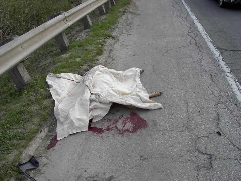
Deer Zero, SUV Zero


I was travelling along the Bayview extension just south of the Brick Works when I came across this sad sight. A police cruiser, a tow truck, and a battered SUV were also there. Without thinking, I quickly stopped my bicycle and pulled out my trusty camera and snapped this photo. The cop whistled at me. "Hey!" He snarled. "Beat it. I don't need another distraction." So I quickly packed up and went on my way.

A little later on both cop and tow truck pulled into the Brick Works parking lot so I was able to examine the car closely. Both headlights were smashed, along with the front grille and the hood was crumpled. The radiator was pushed in. About $2-3000 of repair work. The driver was shaken up but unhurt.

Apparently the deer was trying to cross Bayview during rush hour. It was very busy. Of course since deer have been spotted in the valley for the past three years, this was bound to happen eventually. A tragic result of the impact that we humans have on the natural environment.

Wednesday, August 24, 2005

Flooding in Taylor Creek Park

One of my varied volunteer duties is webmaster for Friends of The Don East. FODE, as the group is known, concentrates its activities in the Taylor-Massey Creek watershed as well as a few other places that resided in the old borough of East York, their primary base.

Anything that appears on the FODE website usually has to do with that area of the Don. So among my travels to observe the flood damage I visited Taylor Creek Park and took a few pix of the flooding. I wrote a short article to accompany them and posted all this to the FODE website.

Rather than repeat it all on this blog, I am just providing a link to the story.

Enjoy.

Monday, August 22, 2005

High, but not that high


Beechwood Wetland shows signs of inundation. Now we need another rain to wash all the muck off.

I went on a ride down the Lower Don Trail from the forks to the mouth. Most of the trail was covered in water with only a few high spots left dry. Now that the water has receded, everything is covered with a layer of mud and dirt. Beechwood, Binscarth, Helliwells Hill, Chester Springs were all inundated. The lower pond at the Brick Works was part of the river at one point.

What surprised me the most was that the lower part of the river was untouched. There was hardly any flooding south of Queen. The real bottleneck - the Lakeshore railway bridge - showed less than 25% of overflow capacity. All the flooding upstream was a result of localized overcapacity. The berm being built south of Queen would not have even being touched.

The big hope is that flooding such as was seen on Friday will be mitigated by the Wet Weather Flow Management Plan. This 25 year plan started in 2002 will make changes to source and and terminal control points so that when rain falls it doesn't all flood into the valley all at once. The only problem of course is that WWFMP only applies to Toronto. Water flowing from north of Steeles is still uncontrolled. Maybe Markham and Vaughan will be forward enough in the planning to start their own WWFMP's (ha!)

After the storm


While I didn't view Friday's storm personally I did see the news reports of flooding on the Bayview extension. The river was up and still flowing muddy all weekend.

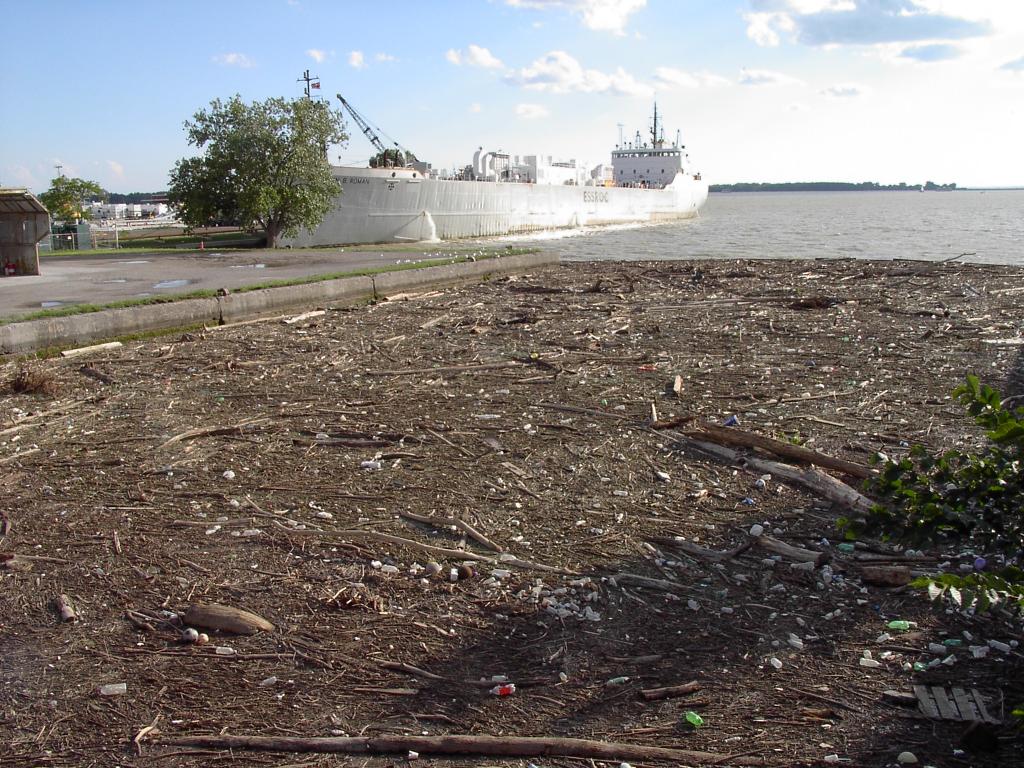
I passed by the mouth of the river late Sunday and took this photo of the mouth from the lift bridge on Cherry St. This is some the debris that floated down the river that was captured by a boom to prevent it from going into the harbour. It looks thick enough to walk across.

This is just one of the issues that needs to be addressed by the Don Mouth EA (See previous post).