Monday, May 06, 2013

New path for the Don Valley

The new trail looking north from Gerrard Street East

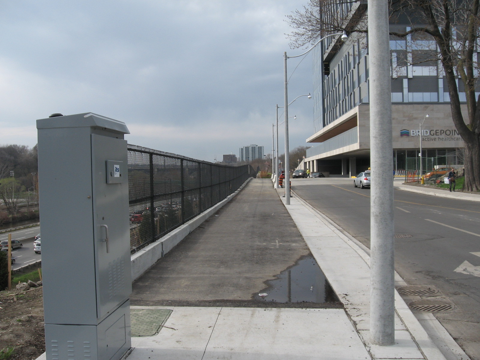
Now that the new Bridgepoint Health Hospital has opened up and landscaping is almost finished, a long promised connection along the west side of the property is now open for use. A new path has been established that runs between the new hospital building and the Don Valley Parkway. The path starts at Gerrard St. East at a new light just east of the bridge that crosses the DVP. The path starting at the NW corner of the intersection proceeds north along the edge of the fence and provides a new access point to Riverdale Park East. Currently the path just ends at the grass. The city has yet to build a connecting path so for now you'll have to traverse about 50m of grass and dirt before you get to the paved path that provides access to the park and the pedestrian bridge that connect to the west park and to the Lower Don Trail.

The path is an easier grade and is more convenient to park users who need to get to Gerrard Street and the local neighbourhood.

Please note that landscaping along the trail is not yet finished so the trail may be temporarily closed while work is being done. Official opening of the trail has not yet been announced but already people are using it so it should be OK for use most of the time.

The new trail at St. Matthews Road and Gerrard Street East, looking northwest


The trail is right next to the new hospital

Looking south along the trail. Note that the landscaping is not yet finished

The place where the trail enters Riverdale Park East

Sunday, April 28, 2013

Don Species: Trout Lily

Trout Lily
 
Scientific Name: Erythronium americanum
Status: native, common throughout southern Ontario
Where is it found: rich woods, usually in vicinity of sugar maple or beech trees
Where was this photo taken: Crothers Woods
Blooming period: March - May
What's its place in the world: belongs to a class of plants called spring ephemerals. It blooms in wooded areas before the trees leaf out allowing it to flower and seed within the shelter of the forest. An interesting study done in 2002 showed that it can form symbiotic relationships with soil fungus and neighbouring sugar maple trees. I've also seen it near the base of beech trees so it is likely the relationship is there too.

Tuesday, April 02, 2013

West Don Bridge/Walkway Replacement Still Ongoing

Bridge is closed. To open in May?
 
In January I blogged about the status of the walkway/bridge replacement project that links E.T. Seton Park and the West Don parklands with the rest of the Don trail system. The prognosis back then was that the new walkway would be installed by early March. Sadly that is not the case. The walkway is partially installed but not linked up. It looks like decking still needs to installed in the metal frame as well as the bridge across the railway tracks. It appears that the bridge itself will not be replaced only the decking on top will be replaced. Signs on the bridge now say that the project will be completed by May 2013.

This project which started back which started last August has now lasted 7 months and is still counting. Work is proceeding at what looks like a glacial pace. Project management is obviously not one of the Parks departments strong suits. If we're lucky it will be open by August.

Metal walkway in process of being installed. Parts are not yet linked together

New walkway has metal bottom and sides. It looks like there will be some sort of wooden decking.


Despite fencing and signs, trail users are still scrambling through the construction site.

The good news is that the Lower Don Trail is now completely free of ice.

Saturday, February 16, 2013

East Don Trail Environmental Assessment

A public meeting was held in a school gym close to the east Don in Flemingdon Park. It just happened that I captured two of the three councillors who attended this meeting in this picture. Can you spot them?


I attended a public meeting this week that was the first in a series to talk about a proposed trail through the East Don Valley between Lawrence Ave. East and the forks of the Don. The forks are roughly where the east and west Don River branches and also Taylor-Massey Creek join together. The trail will be built to the standard size of about 3-4m in width paved with asphalt. This is necessary to meet accessibility standards and coincidentally wide enough to accommodate Parks and Rec vehicles.

This meeting kicks off the Environmental Assessment process. These public meetings are a part of that process (the city must hold them). The EA will investigate alternatives and eventually recommend a preferred solution. When the EA is finished then construction can commence, conditional on funding of course.

With all projects of this sort there are pros and cons. On the plus side, this trail will connect the north and south ends of the valley and significantly extend the Don trail network. Right  now the valley is used almost exclusively by mountain bikers on a series of quite challenging single track trails and by people living nearby who use it for dog walking and such activities. There are also a few connecting parks linking the valley to neighbourhoods. The trail will open up the valley to a larger section of the populace.

On the down side, the trail will inevitably lead to a decline in the quality of the habitat for animals and plants living in the valley. When people move in other things get pushed aside. The trail will likely negatively impact vital habitats such as wetlands and forest fragments that still exist within the valley.

In addition there are several challenges in building a continuous trail. Just south of Eglinton, the Flemingdon Park Golf Course covers a large swath of the valley. There is not much left of the valley to build a trail unless it takes away part of the golf course. There is also the CN railway which snakes through the valley. Building the trail will require it to go over or under the tracks (a level crossing is a non-starter) which is vary expensive. Then there is the river. In several places the river is actively cutting away at the edge of the ravine wall. There is no space in these sections for a trail. This will entail further expensive bridges to cross the river.

How these challenges are to be addressed is as yet unknown.  A feasibility study done May 2012 is not yet available. The website says that it will be posted shortly but hasn't been. Nor is there any indication of how to get a print copy. The material posted at the meeting is now available on the website.

The city is accepting comments up until February 28, 2013. You can submit comments to eastdontrail@toronto.ca.


A map displaying part of the valley. Participants were encouraged to use post-it notes to make comments.

Tuesday, January 15, 2013

The Legacy of Bring Back the Don


Now that the Task Force to Bring Back the Don is for all intents and purposes a dead duck, it's worth taking a few moments to look back over the 20 odd years of its existence and wonder what if any legacy came from it.

The Task Force started in 1989 at a conference held at the Ontario Science Centre organized by a groundswell of interest about the Don River and the surrounding valley. Long neglected and even declared dead (there was even a funeral!), there were still a few supporters for this hard to access natural space. After the conference which included such luminaries as Jack Layton, the Task Force was formed officially as a city committee in 1991. It was not without difficulties though. It didn't receive any stable funding because conservative forces were opposed to its existence. Alderman Tom Jakobek (he of the MFP leasing scandal) at the time said "The Don River may be dirty but I don't want to see it become an NDP sewer for capturing endless public funds."

This didn't stop them from raising funds for projects from a variety of public and private sources. One of their first projects was to create a book called "Bringing Back the Don". Published in 1991 by the City of Toronto,  it sketched a vision for how the Don could be revived. It included many ideas that were revolutionary at the time but now seem quite ordinary. It has been cited many times by students, urban planners and landscape architects. It helped influence a generation of thought on environmental restoration.

The Task Force was instrumental in creating "Chester Springs Marsh" in 1996. It was called a 'demonstration wetland'. While it didn't work quite as well as planned it did highlight the value of wetlands. In the ensuing years at least half a dozen small wetlands were created or enhanced.  Tree planting was a big activity in the early days and this was how I became involved in 1998. Back in those days the Task Force was one of the few groups doing it but now it seems everyone is doing it. For environmental groups, tree plantings are an easy way to get volunteers involved and act as a springboard for other activities.

While creating wetlands and planting trees were physical legacies of the Task Force, I think an even more important legacy was influencing thinking. The Task Force acted as an advisory body to city council in matters concerning the Don Valley. While this might appear to be a narrow mandate, the Task Force sought and achieved a broader reach by commenting and advising on broader issues such as the Wet Weather Flow Master Plan, the Sewer Use bylaw, the Private Tree bylaw, and the Ravine Use bylaw. All of these issues affect not only the Don but all parts of the City of Toronto. 

Informally we were seen as a kind of think-tank for urban environmental issues. City staff in departments  such as parks, forestry and planning sought our advice for a wide range of topics. I think we were able to educate them and help them learn about the needs of the valley. This knowledge (I hope) is still retained by the city and will continue to influence function and policy well beyond the term of the Task Force. Many of our members participated in other places such as advisory committees, environmental assessments, and other non-profit organizations. I know several of our former members who are involved with or founded such groups as Lost Rivers and Park People.

So the Task Force to Bring Back the Don is done. Did we succeed in bringing back the Don? I would say a little bit of yes and more than enough of no but we started it on its way. The issues concerning the Don are complex, difficult, and costly to fix. The Wet Weather Flow Master Plan started in 2005 and has a 30 year plan. If everything in that plan is accomplished than the Don will be in much better shape. However, the Don Watershed is the most urbanized watershed in Canada and that is the biggest driver of Don issues. The river has been permanently affected by our activities and we will never restore it to its former glory. But if we keep thinking in terms of the river and its needs we have at least changed neglect into respect.


Thursday, January 10, 2013

E.T. Seton Bridge Project Status

E.T. Seton Bridge Project.


Map Legend
Green: open trails (not plowed)
Red: wooden ramp removed, access extremely limited
Black: approximate placement of temporary fences
Blue: informal detour (use at own risk)

I visited the bridge replacement project site at the south end of E.T. Seton Park. It looks like the construction company has abandoned the site for the winter. Some fences are still up but all is not lost. The bridge across the railway tracks is still usable and if you are coming from Don Mills and Overlea (Flemingdon Park) you can still access the bridge via a narrow set of stairs. However the access ramp from E.T. Seton has been removed and is impassible except for the most intrepid of hikers. Getting a bike through here is next to impossible. There is an alternative informal path but it involves crossing the CN tracks and I can't recommend that but it appears that some people are using it. So despite the signs and fencing there is currently limited access. 

I heard through councillor Jaye Robinson's office that a metal ramp will be installed late February, early March. It was my understanding that the Bailey bridge crossing the tracks would also be replaced. There is no word on when this will happen.


Project sign. The recommended detours are laughable at best. I doubt anybody bothers with them.

The bridge is still up. The former wide wooden stairs at the north end have been replaced by a set of narrow stone stairs. Not very bicycle friendly.

The old wooden ramp has been removed. Cement foundations have been put in place in preparation for a new ramp which has yet to be installed.
A look at the bridge with some interesting graffiti/art on the right.

Wednesday, January 09, 2013

Back At It, More or Less


Back at blogging that is. I've never really left it, since I've continued my involvement with the city's Community Stewardship Program, and participation with Friends of the Don East and the TRCA's Don Watershed Regeneration Council. Plus other volunteer activities at various sites.

I started the blog as an offshoot of the Task Force to Bring Back the Don. Originally, I wanted to communicate to my fellow members my experiences with the Don River and valley. I tried email, and then a yahoo group before I started the blog. Since then I have involved myself through Twitter and recently Facebook.

For awhile the blog was all there was. I put everything there including announcements, events, and my irregular opeds. Blog posting would sometimes simply be a link to somebody`s news article or even just a photo. Then Twitter arrived and I found that it was a better vehicle for the short stuff.

In 2010, Rob Ford was elected as mayor. Ford was the new man on the block and he wanted to put his own stamp on the city. Unfortunately, this included suppressing citizen involvement and he killed off 95% of the citizen committees that had remained throughout the Lastman and Miller eras. This sweep included Bring Back the Don. There was some backlash to this but through delay and obfuscation he effectively killed off the Task Force. Technically the TF is not completely disestablished, but the inability to hold meetings or recruit new members meant that the remaining active members eventually lost interest and moved on to other things and the TF is now for all purposes kaput.

During this time I lost interest in blogging and my interest lapsed except for a few Twitter posts. But I have received a few queries about the status of the blog and it appears that there is a larger constituency out there than just the old Task Force that is interested in the Don.

So I am going to try again. But rather than focus my attention on the blog I will be looking to increase the outreach by connecting through Twitter and Facebook. So if you`re an old blog follower, try cruising over to Facebook or follow on Twitter. Interesting things are still happening with the Don River, the valley and the watershed. There are still more things to be said and done before I am dead and gone.

Sunday, November 06, 2011

Getting to the Brick Works from Pottery Road


Three possible routes: red, green, and yellow (see below for descriptions)

The Don Valley Brick Works has undergone a transformation in recent years and has opened up under the care of Evergreen Canada as the Evergreen Brick Works. Evergreen has done a masterful job of restoring the buildings and updating the site for multiple uses including a farmer's market, a native plant nursery and a skating rink in the winter. The place is worth a visit.

Unfortunately access other than by car has been and continues to be a challenge. The TTC runs a bus there but only on Saturdays. The 28A Davisville bus extends its route to the Brick Works 8AM - 6 PM. Evergreen offers a shuttle bus from Broadview subway station that travels every 20 minutes between 7 AM to 7 PM (4:30 PM on weekends). Access routes by foot and by bicycle remain difficult and at times safety-challenged.

Improved intersection at Bayview Avenue includes a new pedestrian crossing on the north side

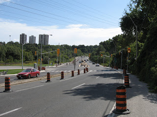
Recently the city has done a complete makeover of Pottery Road. It was supposed to re-open September 5 but due to issues with an unstable slope it remains closed until November 30. Fortunately, there is safe access for pedestrians and cyclists to make it through. In addition there is now a pedestrian crosswalk (with a crossing button on both sides) at the intersection of Pottery Rd and Bayview Ave so this is definitely a positive step forward.

Therefore it makes sense to review the access options to the Brick Works from Pottery Road. If you look at the map, there are three possible routes. Based on colours I will describe each route and their pros and cons.

Red Route


Path up side of hill. Ravine access road is just to the right (don't go that way)

From the intersection at Pottery and Bayview, cross at the lights and turn right (north). Go up the hill a short distance. When you reach a park access road that winds up through a small ravine to the north west, you will also see a dirt path going up the hill to your left. This path is very steep and can be slippery in wet conditions but can be managed with care. I don't recommend this route for any cyclists except those with good mountain bikes. At the top of the hill you will find a railway. It's OK - currently it is not in use and there are even small trees growing through the ties. Cross the tracks and scramble up a short steep embankment and this will bring you into the north east corner of the old quarry.


View of Brick Works ponds from the top of the slope

The top edge offers one of the best views of the quarry ponds. There is a dirt road which goes south and this will lead you to the north edge of the Brick Works complex. While going down the winding gravel road you will see a climbing tower built by Outward Bound, one of Evergreen's tenants. You can also take a detour to a lookout or scramble down the slope on one of the informal paths that lead into the pond area.

Green Route


Median is about 2m wide but only a painted line separates you from traffic. Be careful!

From the intersection at Pottery and Bayview, cross at the lights and turn left (south). Follow the paved median beside Bayview. This can be a bit unnerving because traffic comes up behind you at quite a clip. The speed limit on Bayview was recently reduced from 70 kph to 60 kph but this doesn't make you feel much safer. As you continue along around the corner you will notice a new access road that gets you into the back parking are of the Brick Works. At some point there will be Jersey barriers placed along this route but until then care must be used here. This is the shortest access route and is usable by both walkers and cyclists.

Yellow Route


Start of Yellow Route trail

This route starts immediately on the west side of the CN railway crossing. Getting to this point is the hardest part because you must cross two lanes of traffic with no aids other than your wits. When you cross the river, the only pedestrian access is on the north side so you need to cross the tracks and then scoot across the road (there has been talk of building a pedestrian bridge on the south side but this will be sometime in the future when gravy stops flowing down the Don River). Care must be used at this point. Once you make it across Pottery Road, this route turns out to be the nicest of the three.


Trail runs close to railroad so be careful

The informal path here follows a route between the railway tracks and the road. Safely ensconced between road and rail the path allows for mostly single file passage almost all the way to the entrance of the Brick Works. The path exits onto Bayview about 25m east of the lights. Fortunately a newly installed pedestrian activated button allows for easy crossing of Bayview. This route was recommended by me as the preferred route but unfortunately due to a point where it narrows near a rail installation, the city wouldn't go for it.

So there you have it. Recent changes make for easier access. Eventually the Green Route will be improved. Until then you can choose your preferred route based on your own comfort level.
Sunday, October 30, 2011

Peek at the Creek


On Wednesday November 2, 7PM at the Stan Wadlow Clubhouse, Councillor Janet Davis will be hosting a community meeting to discuss recent and proposed changes for Taylor Creek Park and the East Don. This should prove to be an informative meeting for anyone interested in the Don Valley.

Note about directions: Listed as 373 Cedarvale Avenue, Google Maps shows this address at the corner of Cosburn and Cedarvale. The arena is on the corner. The clubhouse is actually further up the street just north of the arena down a short roadway. See you there!

Wednesday, October 26, 2011

Milkman's Lane Closed


Just north of Castlefrank Subway station is a secluded but well used path that provides a way down into the Don Valley. From the bottom of this path you can access the Don Valley Brick Works and the Belt Line path. How Milkman's Lane got its start is something of a mystery but local legend has it that when milk was still delivered to homes in the morning, this path provided a back entrance for milk carts for the tony neighbourhood of Rosedale.

Regardless of its origins, this well used access path is under severe stress. Whenever it rains, water sluices down the middle of the path creating deep furrows. This creates a hazard for both cyclists and pedestrians as they try to navigate the path.

This fall the city has decided to do some repair work. A new path will be constructed. When completed, the path will be raised in the middle with drainage ditches on the side to collect runoff. Cedar rail fencing will delineate the path but also limit dogs to the path to protect the fragile forest slope on either side of the path. In addition, informal paths that lace the nearby slopes will be closed off to allow for natural forest restoration.

The path is set to reopen, barring unforeseen delays due to weather or site problems, by mid-December 2011. For further information on this project see this page on the city's website.


Milkman's Lane


Rain runoff is creating deep gullies in path

Thursday, October 20, 2011

Pottery Road to Open by November 30


Unstable retaining wall on Pottery Road

Word has it that Pottery Road will be reopened for road traffic by November 30. The problem was due to an unstable retaining wall that was due to the fact that they cut away too much of the slope behind it which led to the possibility of the slope collapsing. The retaining wall as constructed would then have failed.

A engineering solution has been chosen. I don't whether it is a strengthened wall or some sort of slope stabilization (or both) but it should be complete in a month. Work on the rest of the road is nearly complete. In the meantime, the pedestrian/bike path is still usable. I advise caution in its use as construction activities are still on-going.

Tuesday, October 11, 2011

Relic of ParticipACTION


Old ParticipACTION fitness station

If you're going through Taylor Creek Park you may notice this odd set of stumps painted a faded green. Behind it is a single tall post painted the same colour. If you didn't know what it was you might think, maybe an unusual rest stop or maybe some strange outdoor urban art. Yet for those who have been around awhile, you'll recognize it as a relic of a moribund fitness program created by a Federal government initiative entitled ParticipACTION. This program which was started sometime in the late 70's (and apparently is still active) was created to try and get Canadians more physically active. In a few Toronto parks they created a series of fitness stations where you would do a series of calisthenics You were then supposed to jog to the next station. The post at the back had a sign mounted at the top to demonstrate the exercise. Presumably this station was for some sort of leg exercise.

It seemed like a good idea but it never caught on. These installations were put in place way before there were any fitness clubs. Nowadays, people workout at their company or at the neighbourhood gym. Fitness in parks is relegated to walking the dog or riding bicycles. Now we're left with a series of rotting relics. How quaint.

Wednesday, October 05, 2011

New Wetland in Taylor Creek Park


New wetland under construction

The Taylor Creek Park ravine is blessed with several areas of natural water discharge which has created marshy areas at the bottom of both sides of the ravines. These manifest themselves as cattail covered wet areas that are not too interesting from either an aesthetic or ecological perspective. One step up from a cattail fen is an open water pond. Ponds have a much greater diversity potential allowing habitat for mammals, birds, and amphibians. Since this ravine has been highly modified by human activities over the past 100 years, all of the natural ponds were filled in. From a natural environment perspective it makes sense to improve habitat by recreating them.

This has recently occurred just west of the O'Connor Bridge. A new wetland has been excavated in one of the cattail fens. The area is covered in natural water that flows into the nearby Taylor-Massey Creek. It doesn't look like much now but by next year this time it should look more like the new wetland further up the valley.


Mallard duck checking out the new pond

Monday, September 26, 2011

Pottery Road Open (for Bikes)


Pottery Road closed at Broadview Avenue

A recent article in the Toronto Star highlighted the recent makeover of Pottery Road which apparently isn't going all that well. Apparently the slope behind a new retaining wall is unstable and they can't guarantee that it won't collapse so they've put the reopening on hold until they figure it out.

While the article said that car traffic is disrupted, they neglected to mention that the new bicycle/walking path is complete and fully available for use. A sign at the top of the hill says the path is closed but you can safely ignore it. The path which is separated from the road by jersey barriers is about 2m wide and fully paved. Caution is still warranted as the railing on the hill side hasn't been fully installed.

So too bad about cars but cyclists and hikers can rejoice!


Sidewalk sign says closed, use other sidewalk but there is no other sidewalk (hint: ignore sign)


Looking down the hill - brand new pavement


Looking up the hill. Retaining wall in question on the left


Wide path beside road. Todmorden Mills on the right, Fantasy Farm on the left


Expanded path underneath the DVP


New connection to Lower Don trail


Intersection at Bayview now includes a pedestrian crosswalk. The other side leads to an narrow paved median which can be used (with caution) to access the Brick Works.


Another view of the intersection at Bayview

Thursday, September 15, 2011

Leaside Spur I: Orphan Trail Needs Linkages

Map of the spur (the image is a little small. Click on it for larger image)
Legend:
  1. south end of the trail
  2. informal path and remnant track
  3. crossing at Lawrence Avenue East
  4. crossing at Tallwood Park
  5. crossing at Bond Road
  6. north end of trail
  7. York Mills Road
Starting just north of Eglinton Ave. East, just east of Leslie Street is a little known railpath which was once known as the Leaside spur. It starts just north of Eglinton, crosses Lawrence Ave. East and ends just south of York Mills. It once served the industrial area of south Don Mills and also served as an important cross link between the CP tracks to the south and the CN tracks to the north. In 2003 the city bought the right-of-way and turned into a walking trail. However, it is of little use as it starts and ends nowhere.

Up until now it has seen little use other than the occasional neighbourhood dog walker. But recently it has been resurrected as a possible part of the mayor's vision to create a city wide network of off-road trails.

A recent article in Grid TO prompted me to go take a look for myself. Here is what I found. From the southern start north to Bond Road the trail has been covered with a new layer of gravel, likely in preparation for a layer of asphalt. There are three places where it intersects with existing trails and circles of brick have been placed there to demarcate the crossing. At Lawrence Ave. East a new signalled crossing has been constructed although it is not yet in operation.
The new trail construction ends at Bond Road.

North of this point the trail continues but it is in the same state as the original walking trail. It is still covered in loose stone and cinder block that makes walking difficult let alone cycling. The trail ends again where it meets the CN main line just where it leaves the Don Valley on its way north to Richmond Hill.

There's more to this story than just these pictures. In a second installment I'll look at planned and proposed uses for this trail.


South end of trail (#1). Beyond fence is CP rail main line that crosses Eglinton Ave. East just east of Leslie St.


Informal trail leads to one of the properties on Leslie Street. The trail continues on the other side of the tracks


Just north of the informal trail you can see a remnant of an old spur (#2)


Last remaining track beside warehouse that is now used by Canadian Tire.


New crossing at Lawrence Ave. East under construction (#3)


Trail intersects with another path (#4) that leads to Talwood Park (to the west) and Duncairn Park (to the east)


New surfacing to end at Bond Road (#5)


Trail continues north of Bond Road. Note loose gravel surface that was hard to walk or ride on


North end of rail path (#6). Beyond is the CN rail main line


York Mills bridge across tracks can be seen to the north (#7)