- base flows - 4 cubic metres/sec,
- 10 year flood - 250 cubic metres/sec,
- Hurricane Hazel - 1694 cubic metres/sec!
The meeting was well attended. Many of the faces (and opinions) I recognized from previous meetings. The presenters took us quickly through what has happened to date, then they went into detail about the various options.
First, there are five different channel profiles that could be constructed from a lacustrine marsh to a created wetland. Then there are six different vegetation communities that could exist in and around the channel. Eliminate the obvious losers and tie the remaining ones to the four exit options gives 14 viable options.
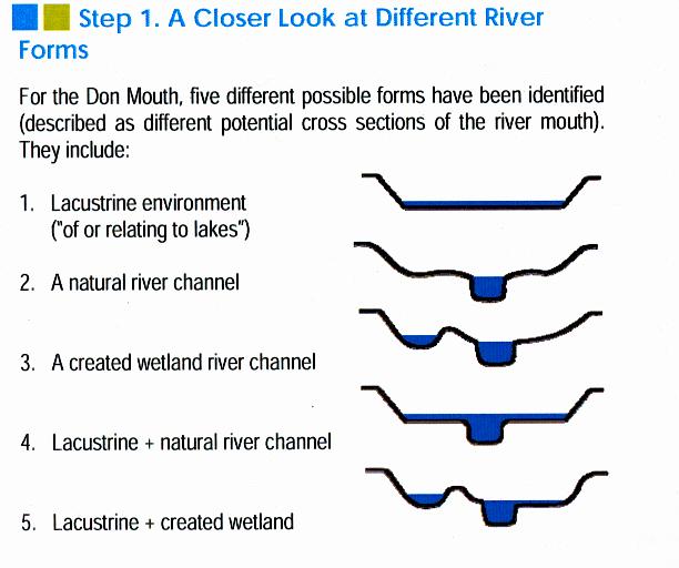
Five alternatives for river channels

Six different vegetation communities
The next step in the process will be studying the various alternatives in detail and narrow it down to a short list of 2-5 options. Based on the presentation, it seems that they are already leaning towards the dual channel option. This would have the base flow directed towards the harbour or the ship channel with an alternate channel that is mostly dry. The dry channel would accommodate heavy floods which would normally overflow a single channel.
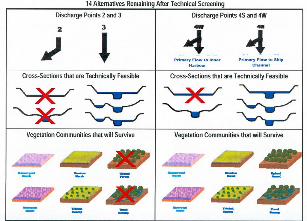
14 viable alternatives
They also talked about the criteria that they need to evaluate and it is a daunting list:
- naturalization
- flood protection
- operational management of the river
- integration with infrastucture (roads, railways, sewers, etc)
- recreational and cultural opportunities
- coordination with other planning efforts
No comments:
Post a Comment