Saturday, December 30, 2006

Linchpin of the Lower Don

Quick question - what’s the most interesting construction project currently underway on the Lower Don - is it the restoration of the river mouth? Is it the creation of the Don River Park and the West Don Lands?

If you answered yes to either of these questions you'd be wrong. The most interesting project is the reconfiguration of the railway bridge just north of Lakeshore. Officially known as the "Kingston Overpass", this bridge has caused many problems for the Don River. Not to say that it has been the instigator, rather it has been against this intractable obstacle that problems with the river have been revealed.

It all started about 50 years ago when Hurricane Hazel roared through Toronto in its history making path of destruction. While the main loss of life was in the Humber River valley, Hazel dumped record amounts of rainfall in the Don River watershed. All this water rushed down the valley. Whereas water in the Humber emptied unimpeded into Lake Ontario, the Don flood came up against the railway underpass. The flow of water was over 400 times the daily flow so there was not enough space for all that water to flow underneath the bridge. The water had to go somewhere and it overflowed the banks as far east as Leslie Street and as far west as Bay Street.

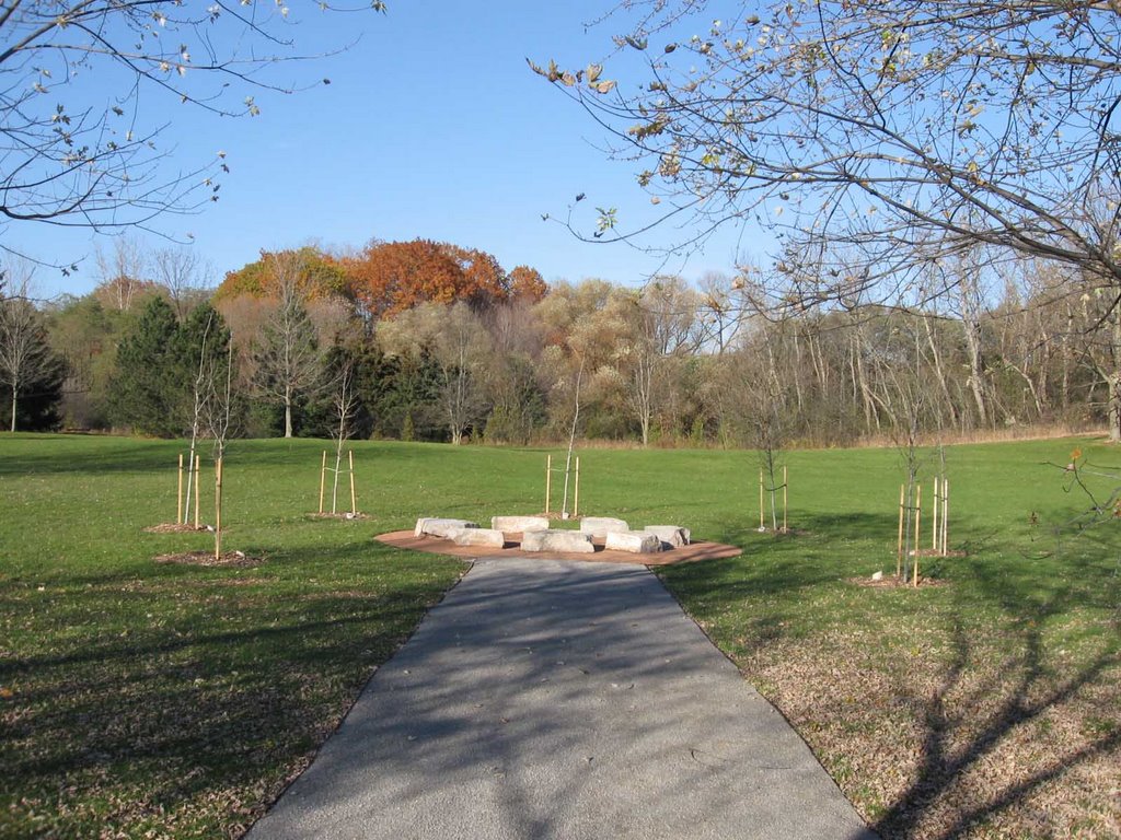
Since then the impact of the flood has set the benchmark for all future development. The main reason why the West Don Lands has remained derelict is mainly because the Toronto Region Conservation Authority has a veto over any development. They insist that any new building be floodproofed against a reoccurrence of Hurricane Hazel, something that a majority of builders find too expensive. The naturalization of the mouth of the Don has also been delayed because no one knew how much water would flow south if the bridge were ever reconfigured.

Then along came the Waterfront Revitalization Task Force and they made the mouth of the Don and the West Don Lands redevelopment two of their priorities. In order to accomplish this, they had to fix the flooding problem. Much to everyone's surprise this is now well underway.

Basically, the idea is simple - in order to eliminate the flooding north of the bridge all you need to do is give the river more space to flow underneath the bridge. A simple idea but a complex implementation. Not only do you have to increase the span length you also have to do it while the bridge is still in use. The bridge contains four separate tracks that carry Go trains and other trains every day.


New construction creates two new underpasses

The construction procedure has been straightforward but meticulously slow. They divided the bridge into two sections. The northern half of the bridge (two tracks) were closed down and torn up. They excavated a new underpass on the west side of the river and built a new span over top. Concrete was poured and new track was laid. This process was also complicated by the fact that the space where they were excavating is also occupied by a high power electrical conduit. This had to be relocated as well. To date the northern half is finished and they are now working on the southern half.


Boring new pilings. Construction continues while a Go Train passes by.


Pouring the foundation for the Kingston underpass.


Tight deadlines necessitated work at all hours. Here a girder is installed on the Kingston span.


Pre-poured railbeds installed on top of new span.


Installing the new track.

A second smaller tunnel is also being created underneath the Don corridor that will eventually connect the trail to the new Don River Park and the West Don Lands.


The new tunnel to connect to the Don River Park.


Excavation the tunnel. The round posts on the right are the original pilings from when the railway was first constructed.


Top view of construction on Bala underpass

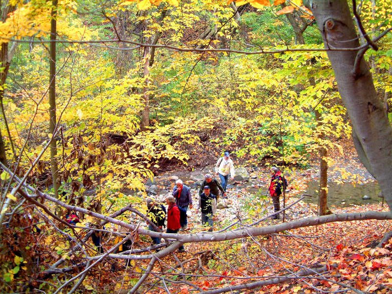
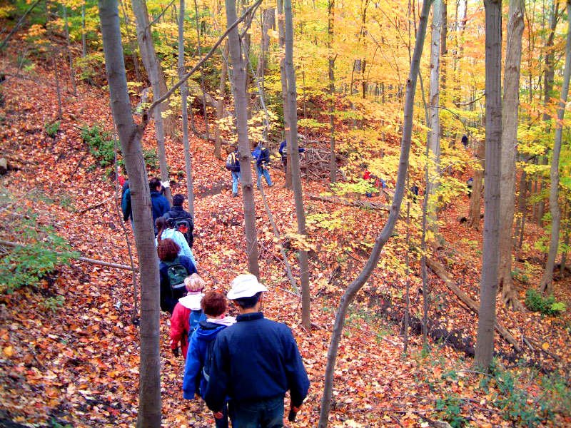
For anyone wanting a more detailed report, please view the Lower Don River West News on the project.

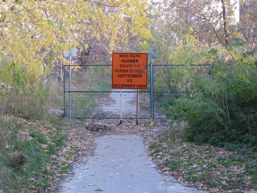
The path is scheduled to be reopened in May. When this happens we will have a new at grade pedestrian tunnel (no more dipping down then up again). Even more so, we will finally have a river whose flow is encumbered by one less manmade obstacle.

Note: Normally I would take my own photographs but due to construction site rules visitors are not permitted onsite. My thanks go to Ken Dion, TRCA project manager and Tony Angelo at Totten Sims Hubicki on behalf of TRCA and TWRC for providing these pictures.

Friday, December 22, 2006

Path Reopens

As reported about two months ago, the Lower Don Trail between Riverdale Park and Queen St. was temporarily closed. This was due to bridge rehabilitation work at Queen St.

I am happy to report that the work has been completed and the trail has been reopened. Of course the trail south of Queen is still closed and won't reopen until some time in May 2007. They are still working on that section.


Reopened trail at Riverdale footbridge stairs


Stairs at Queen St. now open again

Thursday, December 21, 2006

Path Stays Open

At the back of the Brick Works is an informal path. It is a handy short cut to the Moore Park Ravine, one that I use on occasion. It travels through a small section of relatively untouched woods before joining the main (overused) trail. A couple of months ago someone in Parks decided that they would try to dissuade users from using this trail since it is not an official path so they planted a few trees and shrubs on the path (see 'Before' photo).

When I visited the Brick Works yesterday I happened to take a look and found that the plants had disappeared (see 'After' photo). It turns out that someone didn't take kindly to the hint and proceeded to cut all the saplings down. I found them piled to one side. This half-assed attempt at trail closure is a miserable failure.

So it's back to the drawing board for this plan. What's really needed is to implement a more comprehensive plan that addresses all of the informal paths that are creeping into the Brick Works. Maybe then we'll see some progress.


Before


After

Wednesday, December 20, 2006

20 Million for the Brick Works


Ceremonial cheque being presented to Evergreen. (left-right) Lawrence Cannon, Ken Tannenbaum, Geoff Cape, George Dark, and Jim Flaherty.

Today, Evergreen announced that they have received $20 million in funding from the Federal government. This is in addition to the $10 million received from the province. This money will go towards the renovation of the Brick Works to create a mixed use environmental centre which will also act as Evergreen's national headquarters.

The announcement was held at the Brick Works, outdoors. Fortunately, it was relatively mild. It attracted quite a few journalists and TV cameras, more than I've ever seen in the valley. Media stories so far, are spinning this as an environmentally positive announcement from the Federal government. The Toronto Star, managed to put in an anti-Miller dig who wasn't present today. Other reports that I've read include the CBC, and a widely available Canadian Press article.

According to Evergreen, they hope to start work in the summer of 2007 with some sort of opening by 2008-9.

Monday, December 18, 2006

Guided Tour Through Glendon Forest

After Wednesday (last exam) I'll be able to post more (gotta keep my nose in the books for two more days). Until then you can peruse this site that I found. Someone has posted some pictures of Glendon Forest as well as describing a self guided hike that you can take starting at the north end of Sunnybrook Park. The site titled "Toronto Hike - Glendon Forest and Crother's Woods" although there are no hikes listed for Crothers' Woods yet. Enjoy.

Thursday, December 14, 2006

Recent Wildlife Sightings

Exam time sure puts a crimp in my blogging time. Still I have been following this discussion on a local mountain biking website called DropMachine. Turns out that the bikers have been stopping to smell the flowers, er... take pictures of wildlife. So far they posted pictures of hawks and deer, two common residents of the valley (a recent article in the Toronto Star told the story of a deer that was hit on Bayview but taken to an animal shelter to be nursed back to health. Just don't release it back into the Don).

There was also this photograph of a paw print made in an area nicknamed "The Flats" by the biking crowd. This is an area in Crothers' Woods beside the river that they use mostly for building stunts. There has been some fanciful discussion about what made it (do you believe -black bear?) but my guess is it's likely a dog paw print. If anybody knows different, let me know.


Unknown paw print

Saturday, December 09, 2006

Don River in the News

I follow a cycling blog called BikingToronto. Periodically it publishes a summary of traffic accidents, especially those involving bicycles, of which there have been quite a few recently. For some reason they also publish all the other accidents - maybe they have a morbid curiosity.

Anyways, this accident was listed which details a crash on the DVP where a drunk driver veered into another car. A female passenger in one of the cars was ejected from the vehicle and flew over the side of the road and into the river. Personally if I had a choice between landing on pavement and landing in the Don, I'd choose the latter, even if it is a little yucky. She escaped with a broken arm and a few cuts.

Thursday, December 07, 2006

Designing a River Mouth - with an Elephant on Your Back

In the case of the Don River mouth, the elephant is named Hazel, after Hurricane Hazel. That one event set the benchmark for the maximum flow that needs to be planned for. The analogy they gave at the latest public meeting for the Don Mouth Naturalization & Port Lands Protection Project was that the base flow of the Don River is about 3 teaspoons. A 10 year flood is about 1 large jug of water while flows measured during the hurricane were about 6 large jugs. Quantifying those,
  • base flows - 4 cubic metres/sec,
  • 10 year flood - 250 cubic metres/sec,
  • Hurricane Hazel - 1694 cubic metres/sec!
So you can see what the planners are up against.

The meeting was well attended. Many of the faces (and opinions) I recognized from previous meetings. The presenters took us quickly through what has happened to date, then they went into detail about the various options.

First, there are five different channel profiles that could be constructed from a lacustrine marsh to a created wetland. Then there are six different vegetation communities that could exist in and around the channel. Eliminate the obvious losers and tie the remaining ones to the four exit options gives 14 viable options.


Five alternatives for river channels


Six different vegetation communities

The next step in the process will be studying the various alternatives in detail and narrow it down to a short list of 2-5 options. Based on the presentation, it seems that they are already leaning towards the dual channel option. This would have the base flow directed towards the harbour or the ship channel with an alternate channel that is mostly dry. The dry channel would accommodate heavy floods which would normally overflow a single channel.


14 viable alternatives

They also talked about the criteria that they need to evaluate and it is a daunting list:
  • naturalization
  • flood protection
  • operational management of the river
  • integration with infrastucture (roads, railways, sewers, etc)
  • recreational and cultural opportunities
  • coordination with other planning efforts
There were two other presentations but I'll save those for a another blog.

Friday, December 01, 2006

Don Mouth EA meeting

The TRCA is holding another meeting in an ongoing series for the Don Mouth EA. I've blogged about this several times and you can read past notes by searching Don Watcher (use search tool in upper left hand corner).

This notice has been widely circulated but in case your not in the loop, here it is:

The Rise of a New Don
Public Forum #3
Don Mouth Naturalization and Port Lands Flood Protection Project

In August 2006, the Ontario Ministry of the Environment (MOE) approved the Environmental Assessment Terms of Reference (TOR) submitted by Toronto and Region Conservation (TRCA) for the Don Mouth Naturalization and Port Lands Flood Protection Project (DMNP Project).

Toronto and Region Conservation, on behalf of the Toronto Waterfront Revitalization Corporation (TWRC), is proceeding with the Environmental Assessment. The study will identify the alternative that will best transform the existing mouth of the Don River into a healthier, more natural river outlet to the lake, while reducing the risk of flooding to 230 hectares of urban land east and south of the river, and incorporating opportunities for public use and enjoyment.

Join us at a Public Forum and Open House where you can:
  • View the results from the technical screening of alternatives
  • Learn about how the alternatives will be further refined
  • Comment on the proposed evaluation criteria that will be used to select a short list of alternatives
  • Speak with the project team
  • Be updated on related projects

This event supports the TWRC’s mandate to renew and revitalize Toronto’s waterfront.

Tuesday, December 5, 2006
Registration: 6:15 p.m.
Open House: 6:30 to 9:00 p.m.
Presentation/Public Forum: 7:00 to 8:30 p.m.
Metro Hall, 55 John Street, Rooms 308/309 and 304

For more information, contact Michelle Vanderwel at 416-661-6600, ext. 5280, or send her an email.

For more information on the project, please visit the TRCA website. The TRCA has also published a newsletter for the project which you can view here.

Monday, November 27, 2006

Don Videos

Bad poetry? What was I thinking? A quick search of the popular video site YouTube reveals at least two videos where the Don River is featured. The first video entitled "The Don River Project" by three teenagers reveals that talent is not a factor when trying to get published on the internet. The second video called "Old Luke Bootes Sings" is a musical rendition about the 'dirty Don River' although I couldn't detect much about the river itself other than it rhymes with other words.

New pollution source: bad poetry

The Don it seems has a new affliction: bad poetry as this recently uncovered blog attests. Of course poetry is highly subjective, one person's masterpiece might be another's junk. I can only compare this to a previous attempt which Don Watcher sponsored last year: the Don in haiku.

If anyone out there knows of a another (better?) Don poem, I'd be pleased to read it.

Friday, November 24, 2006

Glendon Forest Bloggers

It looks like I was a little too quick off the mark yesterday when talking about a new Glendon Forest blog. It turns out there are two blogs, the first one I mentioned yesterday, the Super Glendon Forest Rangers, plus another one I found called A Field Guide to Glendon's Carolinian Forest.

I am not sure if it's the same group but the information and pictures are certainly different. While there is some debate as to whether Glendon can be truly classified as a Carolinian Forest, it is certainly nice to see someone taking an interest in the natural history of the Don Valley.

Thursday, November 23, 2006

Another Blog for the Don


Map of Glendon Forest (click to enlarge)

During one of my internet sweeps, I came across a new Don weblog called Super Glendon Forest Rangers! It appears to be run by a group of students at York University. Glendon Forest is a medium sized mixed wooded area on the West Don River, between Sunnybrook Park and Glendon Campus, York University. It sports some high quality habitat but is challenged by overuse due to mountain bikers and dog walkers. I wish them all the best and plan to keep an eye on this blog, especially since it is an area I don't get up to very often.


Cut-leaved Toothwort (Dentaria laciniata), one of the many wildflowers growing in Glendon Forest

Wednesday, November 22, 2006

Researching the Don

Recently I've noticed quite a few hits on this blog from educational institutions. Presumably students are searching for information on the Don or related topics. While it's nice that people are learning about the Don from the Don Watcher blog, I don't pretend to be the best source for information.

If you are doing research on the Don there are a number of sources that I like to use. The best source of course is to actually visit the Don regularly and see what's happening. Since the Don is a big place this isn't alway practicable.

If you looking for planning documents the best place is the Urban Affairs library of the Toronto Public Library. It is located on the first floor at Metro Hall, 55 John St. in downtown Toronto. They have a large collection of material related to the Don. A couple of years ago, I did an inventory of the material and produced an annotated bibliography. It needs updating so don't assume it is comprehensive. However it is extensive. The library has also developed a fact sheet on the Don. It too is out of date.

Another good source for information is the Toronto Archives. I found it useful when doing research on items of historic nature such as my Wikipedia article on the Belt Line Railway. Another source for historic information is the Toronto Harbour Commission archives now maintained by the Toronto Port Authority. I have never been there personally but I have been told it is quite useful especially for information on the lower portion of the river, eg. the Don Improvement Project.

Lastly, a good but sporadic source of information is the agenda and minutes of City Committees. In particular, Economic Development and Parks, Works, Planning and Transportation, and Toronto and East York Community Council. The city posts the agenda about a month before the meeting and the minutes about 3-6 months after the meeting. Over the past year I have posted lists of agenda items that I think are important (search the blog for 'city documents' or 'agenda'). You can do your own searches but I have had limited success with the search facility on the city's website.

I hope this helps anyone writing a paper or for some other research purpose. Like I said, you could reference Don Watcher (how do you cite a weblog?), but it's probably best to go to the source. Happy studies!

Monday, November 20, 2006

Crothers' Woods Consultation

A meeting was held tonight at the Todmorden Mills Art Centre to talk about Crothers' Woods. In a room decorated by an amateur art exhibit, about 65 people gathered to discuss ideas for the future of Crothers' Woods. These ideas will be incorporated into a management plan being put together for the city. Once completed the management plan will allow the city to focus on management priorities in the area for at least the next 5-10 years.

The mood at the meeting was one of mostly positive cooperation which bodes well for the future. The audience was a mix of environmentalists and bikers with a few community members thrown in for good measure.

There was also an afternoon session which was invitation only that included representatives of specific stakeholder groups. That meeting featured more focused input. It also featured a rather incoherent rant by a member of the Toronto Field Naturalists. This was unfortunate as they could have provided a good historical context for the area. Still, overall the afternoon session was constructive.

The management plan is being written by a group called The Planning Partnership. They are being assisted on the ecological front by a consulting group called Bird and Hale which performed a botanical inventory of Crothers' Woods.

The plan is for another public meeting to be held in January 2007 that will present the draft plan and the completed plan will be ready by February 2007.

Don Watcher will, of course, be keeping an eye on the process and will update you as things progress.


Crothers' Woods public consultation well attended


Display material at public meeting

Sunday, November 19, 2006

Scenes from Crothers' Woods

As a prelude to the Crothers' Woods Public Meeting, I am posting a few scenes from Crothers' Woods. I took these pictures over the past few years and they highlight some of the flora present as well as the uses that the area gets.


A biker tries a new trail feature in the woods (the treatment plant is in the background)


Hiker's make their way through the woods on a hike with the Toronto Bruce Trail Club


False Solomon's-seal (Smilacina racemosa). This plant produces bright red berries in the fall


Sweet Joe-Pye Weed (Eupatorium purpureum) A provincially rare plant makes its home in Crothers' Woods


Fall colours of Crothers' Woods as seen from the Leaside Bridge.

Saturday, November 18, 2006

Don River Floods... Yawn


A picture of the river overflowing its banks (not from this week, but one flood is pretty much like the next)

So the media is in a kafuffle about the river flooding. What's the big deal? That's what you get if you build on a floodplain.

Thursday, November 16, 2006

Crothers' Woods ESA


Crothers' Woods ESA designation (click to enlarge)

People often ask where Crothers' Woods is in the Don. This means different things to different people but to the TRCA it is a fairly small wooded area extending from the Bayview extension northeast to just beyond Loblaws on Millwood Road.

In 1995 they did a study of the area and based on the quality of the habitat, designated it an Environmentally Significant Area (ESA). This designation is a purely scientific one, it has no legal force to changing municipal zoning or affect any other activities. However it is something that many people have latched onto as a way labelling an area to try and protect it. The Task Force has often referred to the Crothers' Woods ESA in its dealings with the city.

Crothers' Woods is designated as ESA 133. It was given the designation based on two points:
  • Criteria #5 – rare/endangered species,
  • Criteria #6 – exceptional high quality and/or diverse habitats and communities
The rare species are two sunflowers and a sedge; the high quality habitat refers to the forest and the diversity of tree species. If the ESA were updated today it would now include Butternut as an endangered species. This tree which grows in Crothers' Woods is fatally threatened by a fungus that attacks it.

If you want to read the full document (it's only 2 pages plus a map) you can find it online here. Reading this document will be good background material if you decide to attend the community meeting on Monday November 20 (see previous post).

Wednesday, November 15, 2006

Public Consultation on Crothers' Woods

NOTICE:

PUBLIC CONSULTATION ON CROTHERS’ WOODS

(West side of the Don River,

from Pottery Rd. to the Millwood Bridge)

The City of Toronto Parks, Forestry and Recreation is developing a Management Master Plan for the Crothers’ Woods Area.

If you participate in hiking, mountain biking, dog walking, dirt jumping, bird-watching, or other activities in Crothers’ Woods,

we want to hear from you!

Public Meeting

Monday, November 20, 7pm – 9pm, at Todmorden Mills, in the art gallery.

Location: Pottery Road, west of Broadview, east of Bayview

Directions: From the Don Valley Parkway, take the Bayview/Bloor Street exit, then follow Bayview Avenue north to Pottery Road.

By TTC, from the Broadview subway station, take any northbound bus to Pottery Road. It is just a short walk down Pottery Road, in the Don Valley.


FOR MORE INFORMATION, PLEASE CONTACT TRISHA AT: tkaplan@toronto.ca or 416-338-5053

Tuesday, November 14, 2006

Requiem for Jane

Last night was election night and aside from the races where there was no incumbent, there were few surprises. All but one of the incumbents were returned although there were a couple of close races.

As for the mayoral race, David Miller was all but assured re-election. His closest challenger was Jane Pitfield. Jane received 188,932 votes to Dave's 332, 969 votes. While that was more votes than I expected I was not surprised with the end result.

I just want to say a few words on Jane's behalf. The Task Force to Bring Back the Don has 23 citizen members and 3 council members. In the 8 years that I have served with the Task Force, the only council member who has ever showed up to our meetings was Jane. Usually she appeared unannounced and butted her way into our agenda to say her piece then scooted out again, but at least she showed up. She also sent one of her assistants to listen in on our meetings. Having an attentive council member is always a plus.

In addition to her deputations she also helped raise a little bit of money for our yearly expenses with newsletters and other publications.

To our misfortune she took on the rather quixotic task of trying to unseat David Miller. She was much more useful as a councillor and if she had stayed could have served as long as she wanted.

Personally I think she wasn't as good a candidate for mayor as Miller. Whatever naysayers he has, Miller has been a forceful proponent of several environmental issues that the Task Force supports and an advocate for the Don. Much more so than his predecessor (who never once made an appearance at our events).

Regardless, Jane will be missed by us. We can only hope that the next lot of council members will bring us as good an advocate as Jane was.

So if nobody has said it, on behalf of the Don River, thank you, Jane.

Monday, November 13, 2006

Last Planting Successful

Even though it rained heavily early Saturday morning, the weather let up just long enough to plant about 60 things, mostly cedar, sycamore, chokecherry, and sumac. Thanks to James, Jenny, John, Kirsten, Lise, Norah, and Raz for helping out!

Thursday, November 09, 2006

Don Watcher gets Published! (sort of...)


Toronto Water Newsletter (click to enlarge)

For a few years now the city has been issuing a newsletter that covers water related issues. Mostly it's information about downspout disconnections and low-flow toilets but occasionally there is an interesting article. I just received the fall 2006 issue and the front page has an article entitled "Improving water quality in Taylor-Massey Creek".

This happens to be an issue that I am very familiar with and I have blogged about this in the past year (here and here). So I read the article with some interest. Upon reading the article I realized that the text sounded familiar. In fact very familiar since many of the phrases and information appears in a Wikipedia article about Taylor-Massey Creek. I know this article intimately... since I wrote most of it.

Other than this blog, one of my other literary interests is writing articles on Wikipedia. Using the editor pseudonym Atrian, I have written several articles and edited many others. In addition to the Taylor-Massey Creek article, I have written or expanded on Don Valley related articles such as Charles Sauriol, Todmorden Mills, the Belt Line Railway, Friends of the Don East, and the Task Force to Bring Back the Don. I am currently working on expanding the article on the Don Valley Brick Works and hope to create an article on Crothers' Woods.

Even though the article doesn't reference the Wikipedia source it's obvious where they got the information. Although reworded, the phrases are almost exactly what is used in Wikipedia. It gives me some enjoyment in the knowledge that some of my efforts have borne fruit. I can also shamelessly brag about it here!

Tuesday, November 07, 2006

Last Planting of the Season


The pond at Beechwood Wetland

My community stewardship site this year was at the Beechwood Wetland. We spent most of the summer removing invasive plants such as Tansy (Tanacetum vulgare) and Garlic Mustard (Alliaria petiolata). We cut down some Glossy Buckthorn (Frangula alnus) and we had the city come and remove some larger specimens of Black Locust (Robinia pseudoacacia) and Manitoba Maple (Acer Negundo). They also treated remnant patches of Japanese Knotweed (Polygonum cuspidatum).

The result is that there are quite a few gaps in the site. Rather than have them infiltrated by more invasives next year, I asked the city if they could spare some trees and shrubs for the site. They have been busy up until now but I finally managed to schedule a planting for this Saturday, Nov. 11 from 10AM to 12 noon. The site is on the lower Don Trail about 800m north of Pottery Road. There is street access via Beechwood Drive. Park your car beside the road just on the west side of the DVP near the police dog facility.


Location Map (click to enlarge)

We have about 4 or 5 people committed but it would be nice to have more. If you are free this Saturday I would appreciate any help. As an incentive I will give anyone who comes out a loonie. All you have to do is answer this question, "What is the answer to life, the universe, and everything?" (You also have to plant at least one tree).

Sunday, November 05, 2006

Beaver Update: Gone to Hospital

Another reason why dogs should be banned from the Brick Works Quarry area. The beaver that I spotted a couple of weeks ago wasn't moving very well for a reason. It had been severely injured by a dog bite on its tail.

Animal services came and removed it and hopefully will a) nurse it back to health and b) find it a good home. The Brick Works is currently too inhospitable.

Saturday, November 04, 2006

Benefit Concert for Bring Back the Don, November 12


A group called “Hearts Open Toronto” is hosting a benefit concert for Bring Back the Don on Sunday, November 12th, upstairs at the Rivoli on Queen Street West. Danny Marks, a well-known Toronto blues musician (and one of the CBC’s “Hum Line” trio) chose BBTD as the beneficiary of his concert. Doors open at 7pm. It should be a great concert and we all know it’s a great cause so please join us! Tickets are $10 at the door, $5 for students. (It'll be over by 11pm, I promise!)
Also, we'll have fabulous Bring Back the Don T-shirts on sale!

Thursday, November 02, 2006

Last Word on Seed Pod

OK, I just received a message from a local arborist who says that the unusual seed pod that I blogged about here and here is actually a Turkish Hazel or Turkish Filbert Tree (Corylus colurna). He also said that the trees maybe infested by a bug causing the unusual involucres but Wikipedia claims they are a natural morphological trait. It looks like we've found our mystery tree.

Wednesday, November 01, 2006

Another Trail Closure

Ever since the Lower Don trail was closed south of Queen, I haven't been using the trail very much. So I was surprised to find that the trail was blocked by a fence. The sign says its been closed at least a month, although I don't recall when I was down here last... it doesn't seem that long.

Anyways, the reason for the closure is that stairs coming down from the Queen Street bridge have been closed. They are doing some sort of restoration work on the bridge - my guess would be rust-proofing since it's made of iron.

Although the trail is supposed to be closed, you can still sneak by. There are a couple of openings in the fence where you can exit before you get to Queen, although they all lead you to a crossing of the railroad tracks which I don't recommend. Not only illegal but dangerous. If you do, look both ways and then scoot quickly. According to the sign, the construction should be finished sometime in December.


Fence placed across Lower Don Trail at Riverdale Park Bridge


Queen Street stairs closed

Lung Cancer Tree Grove


Lung Cancer Tree Grove

I was passing through E.T. Seton Park on the West Don this week when I noticed this memorial placed beside the path. Sponsored by Lung Cancer Canada, Toronto Parks has planted a circle of Silver Maple trees which surrounds a place to sit on rocks. In 30 years it should be a quiet place of contemplation but today it just looks out of place.

I suppose as long as the city is short on cash, things like this will popup in public places all over the city. Not sure I like the direction the city is taking on this but as long as they stick to the grass areas, we're ahead by seven trees.


Stone Marker

Monday, October 30, 2006

Bike Hike 2006


Route of the hike (click to enlarge)

On Saturday, October 14, I led a hike through the lower Don. It was cosponsored by the Task Force to Bring Back the Don and the Toronto Bruce Trail Club. 30 people attended the hike, even though the Weather Channel was calling for a 70% chance of rain. It did in fact rain briefly late in the day but for the most part it was cloudy with a few sunny breaks. It was a little windy at times but when the sun came out it was a fine autumn day. As these pictures attest the fall colours were stunning proving once again that you don't need to leave the city to see good fall scenes.

Starting at Broadview Subway Station, I led the hike through Todmorden Mills, then up along the biking trails that thread there way through Crothers' Woods. In E.T. Seton Park, we went along a trail nicknamed Party Atmosphere, a technically challenging trail for both hikers and bikers. The last part of the hike went through Serena Gundy and Sunnybrook Park. We then followed the paths beside Burke Brook walking through Sherwood Park and Blythwood Ravine.

The hike started at 10 AM and ended around 3:30 PM with a 25 minute break for lunch. In total the route was about 15 km long. This remains one of my favourite hikes in the valley and I will be doing this one again in the future.


Crossing at the mouth of Walmsley Brook


A view of the valley looking east towards Flemingdon Park


Negotiating a bridge on Party Atmosphere. Ok for bikers but a little steep for walking


Hiking along the trail


Dave Tyson, my backup hike leader

Wednesday, October 25, 2006

Clean, Green, and Accessible

The Task Force to Bring Back the Don has been doing alot of navel gazing recently. Over the past year or so the Task Force has considered the Bridgepoint Health Centre (formerly Riverdale Hospital) development plans and what to do about it. One member, let's call the person Leslie (now there's an androgenous pseudonym), in particular has been very vocal in opposition to these plans. In the end the Task Force voted to not take a position on the development plans, a tacit support I suppose.

Leslie of course was very unhappy with this turn of events and continued to voice disapproval. Leslie said, "IMO, the Bridgepoint proposal doesn't fit with my interpretation of the Task Foce slogan of 'Clean Green and Accessible'. But what does that slogan mean? It's very much open to interpretation. Let's try to nail down a more precise definition. I am sure that if we get it right, it will provide a clearer guideline to future Task Force members on how to approach future proposals like Bridgepoint. That way it will make things easier to make decisions, maybe even create a checklist which we could use to evaluate future proposals to determine if they fit or not. " We said, "OK, Leslie, maybe you're right."

So, over the past 9 months we have discussed, argued, and wordsmithed a longer description of just what is meant by 'Clean, Green, and Accessible'. In the end we produced a document that we could pretty much agree on. But what do we do with it? Do we enshrine it as part of our Terms of Reference? Or just keep it as a position paper? My opinion is definitely with the latter.

The Task Force does not have permanent members. We get reappointed with every term of council. Old members quit, they move out of the city, they get burned out or they simply lose interest.New members get appointed to replace them. Some of us do hang around for multiple terms but that accounts for only about 1/3 of the members. The Task Force has existed for about 5 terms of council and each one has been slightly different. Each citizen member brings his or her own set of qualities and interests and the collective sum has produced a slightly different flavour of doing things. IMHO, it doesn't make sense to try and impose our own world view on future Task Forces because they will likely be different than the current version. So the decision was to leave it as an internal document to be used as an orientation for Task Force members of the future.

Don't get me wrong. From my point of view all this internalizing was a useful exercise. "Clean, Green and Accessible" to me has been a catchy marketing slogan. Now if somebody asks, what do you mean by that? Well now I can whip out this document and say "Here is good description. Take it as you will."

P.S. I was hoping to post the text of the document but it's kind of long so I will save it for a future post.

Monday, October 23, 2006

Beaver at the Brick Works


Signs of beaver damage


Aha! Who might that be resting in the reeds?


Beaver swimming in the pond

I visited the Brick Works last week and discovered that there has been some tree damage. Upon closer inspection it appeared that it was the work of a beaver. Beavers have been spotted periodically in the Don for several years but the lower Don Valley doesn't provide enough habitat for them yet. They like low lying flat areas with slow-moving creeks so they can build a dam and create a small pond. Unfortunately there aren't too many place like this in the Don Valley. Most of the creeks are in ravines that are too steep and when it rains the flood of water is just too great and too polluted for beavers too cope.

The Brick Works might be suitable but there are too many people and (off-leash) dogs around that makes them skittish. Usually they just visit a place, chew down a few trees and then move on which I think has happened to this guy. After the first day that I saw him, I haven't seen him again.

It's good to see that habitat has improved enough to attract beavers but not quite enough to allow them to take up residence.

Thursday, October 19, 2006

Brick Works Petitions

Evergreen's plan for the Don Valley Brick Works seems to have as many supporters as it does detractors. One of the more prominent detractors is Tim Trow who is currently head of the Toronto Humane Society. He has started a petition to raise support to stop the Evergreen plan from proceeding. What he plans to do with the petition or who he is going to deliver it to is unknown.

Trow may have his own private agenda here. He happens to be a local resident and is likely part of the group of Rosedalers who would like to keep the Brick Works as their own private doggie park. He views the plan as bringing an unwanted level of activity that would disrupt his enjoyment of the site.

Trow also has own set of detractors. Not everyone is happy with the way things are being run at the THS. There is some perception that the place isn't being run with the animal's best interests in mind. To that end there is another petition that seeks to get rid of Tim Trow as head of the THS.

It's unlikely that anything will come of either of these. Both petitions will probably end up in the electronic trash bin.

Tuesday, October 17, 2006

Garbage: Here Today, Gone Tomorrow


Dump site


Construction debris


Looks like somebody's former kitchen cabinets

Last Sunday as I was leaving the valley after the trail work, I came across this mess. This is right beside the unwanted dog run (that the city still hasn't fixed but that's another story) just southwest of the Brick Works. There is a gate off Bayview Avenue that accesses a service road for an Enbridge gas pipeline building. It was originally blocked by a metal post locked to the ground but this has gone missing. This allows anyone access to this small secluded field 24-7. Somebody took advantage of this and dumped a load of construction waste, some kitchen cabinets, old tires, empty propane cylinders and some rotten wooden boards.

I took these pictures and sent them to the city parks staff. I expected to wait awhile but much to my surprise they were cleaned up by Monday evening. I was talking to the Bob Ward, the parks supervisor and he thanked me for sending him the pictures. He blames the open gate on another city department (those darn silos).

Anyways it's good to see at least something taken care of promptly.

Sunday, October 15, 2006

Trail Improvements


Pottery Road trailhead is crowded with uses and proposals (click to enlarge)

Accommodating a diverse range of uses in natural areas is a complex task, but it is one where the city is making some headway. In the case of the Don Valley it is trying to manage the needs of mountain bikers and other trail users while also seeking to enhance the ecological function of the valley, something that has been severely degraded in the past.

Over the past 15 or so years, mountain bikers have adopted a series of trails through the Crothers' Woods area of the valley. Unfortunately unmanaged use has not always led to good trail design. Case in point: just north of Pottery Road where it meets Bayview Avenue is an access point for these trails. The ground rises sharply and the first trail to be built went straight up the side of a hill. While this was a quick route it became gullied and eroded as rainwater slowly ate away at the ground. There are now two trails because the first one became unusable. Left unattended these trails would eventually become unusable even for hikers.

Fast forward to the present. The city is now working with the International Mountain Biking Association, or IMBA for short to build a set of trails that will last. Over the past month they have been rerouting the trail so that it runs along the contour of the hill. This type of trail design allows rainwater to flow quickly off the trail and keep it dry.

Volunteers, mostly from the biking community, have been trained on trail construction. Over the past three years they have been slowly fixing the worst spots on the trail. The Pottery Road trailhead is just the latest phase of a long project to improve the trails all the way north to E.T. Seton Park.

Hikers and bikers alike have been hugely appreciative of the efforts by these volunteer trail workers and they should be lauded for their efforts.

The Task Force to Bring Back the Don has also had its eye on this site for a long time as the location of a proposed wetland. Cudmore Creek cuts through this site and the regular flow of water creates the potential for an expanded ecological function. Most of the wetlands in the Don have been lost due to development and places to create a new one are few and far between.

For one reason or another the wetland project has been delayed. In the interim, the parking lot was created, originally as a construction lot for a hydro project but has since been adopted by the mountain bikers. The wetland proposal is still outstanding and may eventually be built which should enhance the ecological value of this area.

With proper management, human uses can coexist with the natural environment. The city is now looking to develop an overall management plan for this section of the valley. On November 1st, they will hold the first in a series of workshops that will give interested users and the general public a say in how this plan is created. Details of this meeting will be posted here when they become available.


Old trail goes straight down slope which is bad for water drainage.


New trailhead at edge of parking lot


The new contour hugging trail winds through a sumac grove


New trail already in use


A work party continues the trail work. The volunteer in the middle is wielding a Pulaski. It's a pick axe that can also be used for digging. It was adopted for trail work from its origins as a forest fire fighting tool.


This tool is called a Macleod, a versatile tool for cutting, hoeing and compacting.


Using the Macleod for broadcasting dirt away from the work zone.

One of the trail crew has posted a Flickr slideshow of Sunday's trail work.