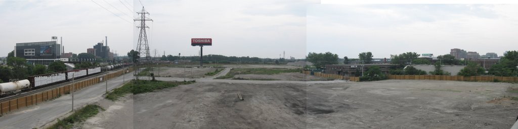
Site of future Don River Park (click to expand)
You might be wondering what is happening south of Queen St. on the west side of the Don River. Among other things they are clearing land for a major new park to be called Don River Park. This expanse will be about 16 hectares (38 acres) and will occupy the land between the Queen St. bridge south to the railway corridor. The photo above was taken from the Eastern Avenue bridge so it doesn't include the section to the north. However you can see this is a fairly large area.
The railway corridor will stay in the same place. A berm will be built roughly where Bayview Avenue is now. Bayview will be relocated to the west edge of the site and will link up will Mill St. which is now out of site around the corner. All of this will form the eastern edge of the new West Don Lands development.
They are currently doing some heavy infrastructure work which deals with modifying the railway trestle to accommodate hurricane flood levels. The trestle was a major obstacle for flood waters during Hurricane Hazel. This is a lengthy project and won't be finished until Spring 2007. However, when it is complete, the Lower Don Trail (currently closed south of Queen) will have a new at grade tunnel under the railway (no more metal cage) and a new east west connection that wil link up with the future park.
As things move along Don Watcher will keep you abreast of the details.
No comments:
Post a Comment